About The Project
Our mission
#wesaynotooldhayes
We, the Coleshill Parish Council's Focus Group, are dedicated to preserving the natural beauty and heritage of Coleshill and its surrounding areas. In response to the potential development of a Solar Power Station on our cherished rural landscape, we advocate responsible solar energy solutions that prioritise brownfield sites, rooftops, and locations away from the countryside.
Our mission is to raise awareness regarding the adverse impacts of such developments, including the transformation of our scenic valley into an industrial landscape, the loss of agricultural land, the loss of biodiversity potential and increased traffic hazards for local communities. We are committed to ensuring that risks associated with construction do not arise.
Together, we strive to ensure that the beauty and heritage of Coleshill are preserved for current and future generations, promoting sustainable practices that align with community values and environmental integrity.

Save Coleshill Countryside
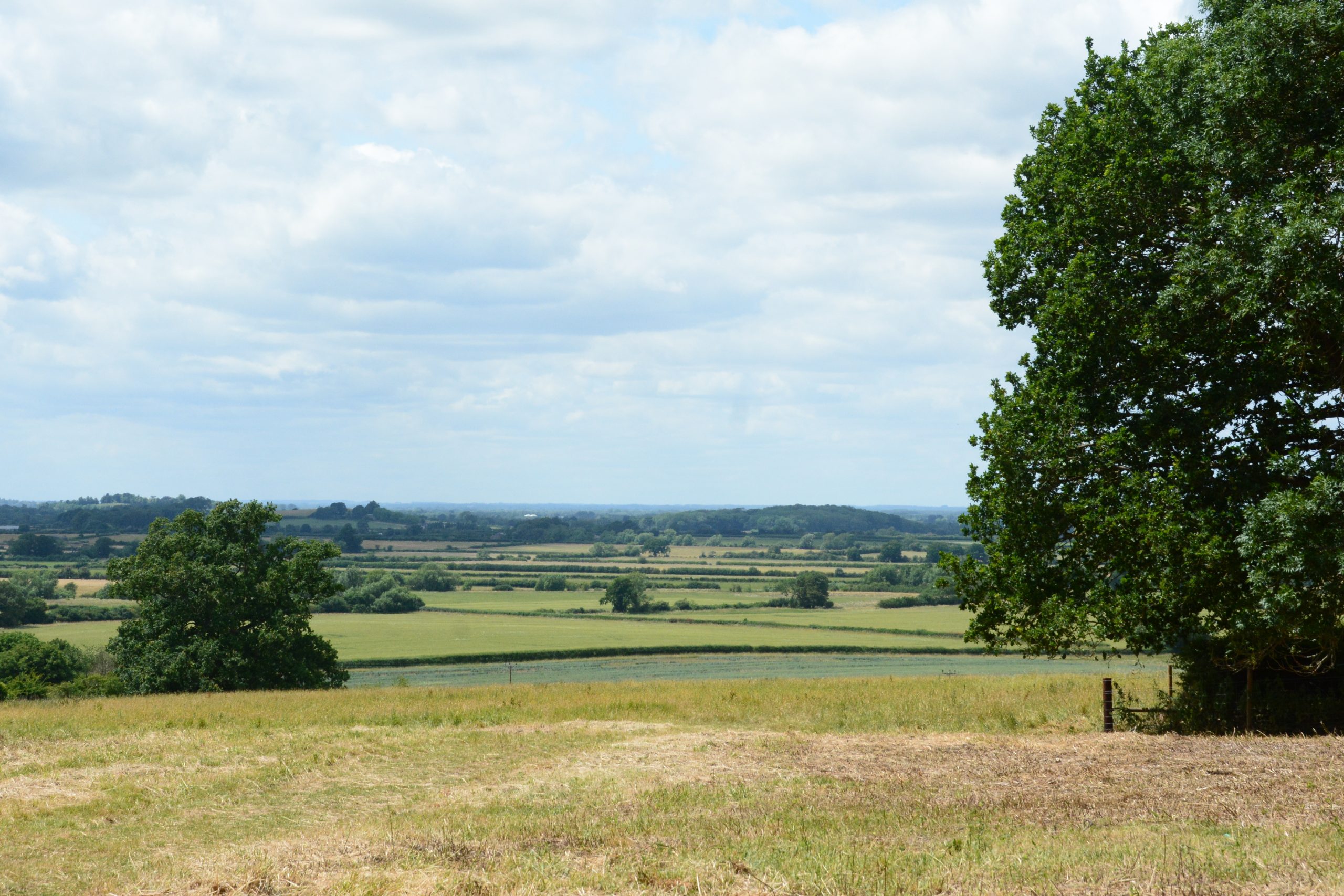
Old Hayes Solar Farm is a proposed development that would transform peaceful countryside into an industrial landscape. It adjoins the historic village of Coleshill, Oxfordshire. The Coleshill Parish Council has formed Coleshill Solar Focus Group with the aim of protecting the rural surroundings of the village from this proposed development.
WE Say no to Old hayes solar farm
We need Green Energy
The Focus Group believes there would be many undesirable impacts resulting from this development.
But we also need Green Spaces
The Group also believes that although green energy is needed, solar panels are better sited on roofs, and Solar Power Stations on land such as brownfield, landfill or areas zoned for industrial use.
Description & Maps
The proposed site
The site of Old Hayes proposed Solar Power Station is in the Parish of Coleshill, on open agricultural land set in the valley of the River Cole, a Thames tributary, west of Snowswick Lane and east of the River Cole, SN6 7PS.
It is bordered to the east and south by National Trust protected land.


Who
Developers: ABEI Energy, a UK subsidiary of a Spanish company. There are 9 proposed solar farm developments in the UK as at December 2025.
Land owner: Mr C S Horton, Poulton, Cirencester, Gloucestershire
What
71 hectares (175 acres) of solar panels
93,000 panels, many raised up to c. 4m (12') due to flooding
20 shipping containers for Battery Energy Storage Systems (BESS)
The site covers 71ha (175 acres). [An earlier plan for a 52ha site was submitted in 2022.] It consists of 9 fields in the floodplain of the River Cole, mostly flat, with gentle slopes towards the river in the central area. The underlying geology is Jurassic Oxford Clay mudstone, and the soils are alluvium and stagnogley (slowly permeable, seasonally waterlogged) clay soils. A gravel aquifer is likely to be at a depth of c1.5m. All fields are currently under arable or short-term grass ley cultivation. All are well-hedged, some hedges with standard or coppiced trees, and many of the fields have grass margins with native wild plants.
The field pattern and tributary streams are all as shown on the 1888 Ordnance Survey 6" map, an interesting historic landscape survival in itself.
The site would be covered by 93,000 solar panels, raised up to c4m above the ground on mountings buried c4m into the soil. There will be a battery storage complex (20+ shipping containers in size) in the southeast part of the site, shown on the map above. Security fencing would surround the site. Metalled or hardcore access tracks would enter from Snowswick Lane. Snowswick Lane would be the route for construction and maintenance plant. It is currently a quiet country lane, well hedged, with National Trust protected land along its whole eastern side. The site would probably be ditched with a new drainage system.
The solar power station would be connected by buried cable routed to a connection point on the Grid at Stratton, near Swindon. The route has yet to be confirmed by the developers.
The site is named ‘Old Hayes’ after the site of a barn complex, dating from the mid-1880s and demolished probably in the 1960s. It is represented today by a few old bricks in a small plantation which is beyond the solar farm proposed site but within the landowner’s boundary, at its south end, marked on the map above by a small green wood.
Right solution, wrong location
Solar energy should be responsibly developed in the right place. Brownfield sites, rooftops, adjacent to motorways or railways, not on agricultural land. The view of the Coleshill valley would change from rural to industrial, affecting residents, surrounding villages and the thousands of visitors that enjoy Coleshill Heritage and countryside every year. A site of the scale proposed would dwarf Coleshill and neighbouring villages.

Land Loss
Destruction of agricultural land with negative long-term effect.

Increased Flooding
Site already floods exponentially, this project will put properties at risk.

Environmental Damage
Serious impact on habitats and wildlife.