
Impacts of the proposal
Our environment
There are many impacts of the proposed Old Hayes Solar Power Station, which could seriously damage its environment and land-use.
- Visual impact on the landscape
- Land-take and agriculture
- Flooding and hydrology
- Wildlife and biodiversity
- Archaeology and land-use history
- Public access
- Change and disruption in Snowswick Lane


This land is not suitable visually for a large-scale solar power station. A study for South Oxfordshire and the Vale of the White Horse District Councils by Land Use Consultants assesses the landscape sensitivity of the areas for solar and wind energy developments. It divides the areas into 14 main Landscape Character Areas (LCAs), with over 40 subdivisions. Our area is 11a, Thames Upper Vale. For a ‘Very Large Solar’, defined as 50-120ha [this proposal is for 71ha] the overall landscape sensitivity rating is High, the highest category of sensitivity. It notes that despite large-scale fields, sensitivity is high due to overlook from higher land, “especially from Coleshill to the south of the LCA”. See p. 195 of the report.
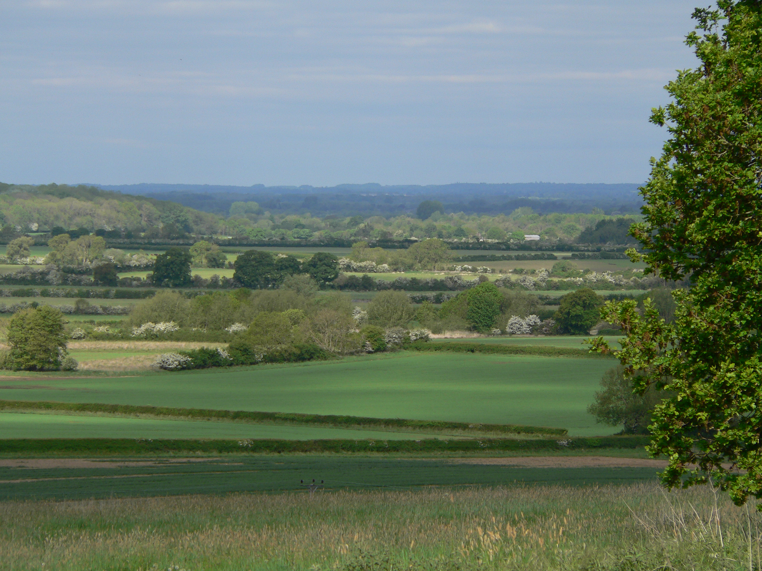
The landscape would change from Rural to Industrial
Thousands of visitors come to enjoy the landscape around Coleshill and Buscot. There are superb views from many surrounding elevated points, and within the Cole valley itself. It would be impossible to mask the proposed solar panels and BESS installations without blocking the entire view. The Focus Group believes that blocking those views by screening is not ‘mitigation’; it is permanent loss.
“Along the Thames and its tributaries, promote sustainable farming in order to conserve and restore semi-natural habitats, historic features, geodiversity, soil quality and carbon stores and to regulate water flow in this area and downstream. … Produce food sustainably and maintain a sense of place.. a farmland habitat mosaic that incorporates..wet grassland, reedbed, wet woodland and ponds as well as ditches and hedgerows.”
This is what we want to see – not a solar farm.
This is what we want to see - not a solar farm
Screening all this industrial infrastructure with trees and hedges is proposed. However, at least 30% loss of planted trees and shrubs can be expected, and planted specimens require hand weeding annually for 5 years, which cannot be guaranteed. Summer droughts have caused massive losses of new plantings in many sites.
Even if hedgerow bushes survive, they will not overtop and hide the high solar panels.
There would be >3,500m of hardened, raised access tracks for machinery within the site. Most of these are sited along the edges of existing hedgerows which will be damaged by track construction, soil compaction and pollution from vehicles. Existing hedgerow trees will suffer. This will certainly appear an industrial site.


Impact: Land-take & Agriculture
The proposed Solar Power Station involves a large land-take – 71ha (175 acres). This is a significant portion of the floodplain of the River Cole with valuable functions as both floodwater storage and agricultural land. The soils are not of top quality for crop growing due to flooding but are inherently fertile, especially the alluvial soils.
Agricultural land is classified in 6 grades according to soil quality and workability of the land for a variety of crops, from 1 (excellent) to 5 (very poor). This land is graded 3 (good-moderate: 3a is good and 3b is moderate) and 4 – poor. The small-scale Agricultural Land Classification map shows the wider locality of the proposed solar farm site, the green colour being Grade 3 (including 3a and 3b) and the yellow Grade 4. More detailed mapping for the Planning Application by Reading Agricultural Consultants Ltd in 2024 shows the whole site to be Grade 3 - dark green is 3a and light green is 3b. There is no Grade 4 poor land here.
Image: Agricultural Land Classification Map including the proposed Solar Farm site, the National Trust Buscot & Coleshill Estate and surrounding land. Blue – Grade 2 (very good); green – Grade 3 (good-moderate); yellow – Grade 4 (poor). Source www.naturalengland.gov.uk/publications

Land in Grades 1 – 3a are classed as Best and Most Versatile land (BMV). 17% of the proposed site is Grade 3a, BMV land. The unmapped area is also likely to be 3a, being on higher, drier soils. 83% of the site is Grade 3b, of moderate quality, currently growing viable arable and silage crops. Government policy aims to protect BMV land from development to ensure food security and protect soils for the services they provide.
This land is therefore valuable for agriculture and should not be developed.
‘Agrivoltaics’ is cited as a reason that agricultural land and solar power stations can go together – this is the use of the land around the panels for crops or livestock. In the case of this Old Hayes proposal, sheep grazing is planned. Whether or not sheep are suitable for wet floodplain land is questionable, as is their commercial productivity. A recent study has identified Cambridgeshire, Essex, Lincolnshire and the wider east and south-east of England as the most suitable for agrivoltaics because of their availability of flat land, strong grid connectivity and the prevalence of solar radiation; only two of these criteria apply to Old Hayes.
https://b.link/planner0506-solartech
It is important to note that this land has been farmland since the Iron Age, if not before. The field lay-out survives unchanged for 200 years, an unusual feature. Several of the hedges date from 1666 or earlier.
Archaeological information provided for the Planning Application states that there is no damaging impact of current or recent farming activity on the great wealth of archaeological remains. They lie safe below the soil. This would not be the case with solar farm development involving deep trenching, cabling and insertion of thousands of panel mountings 2-3m into the soil.

Impact: Flooding & Hydrology
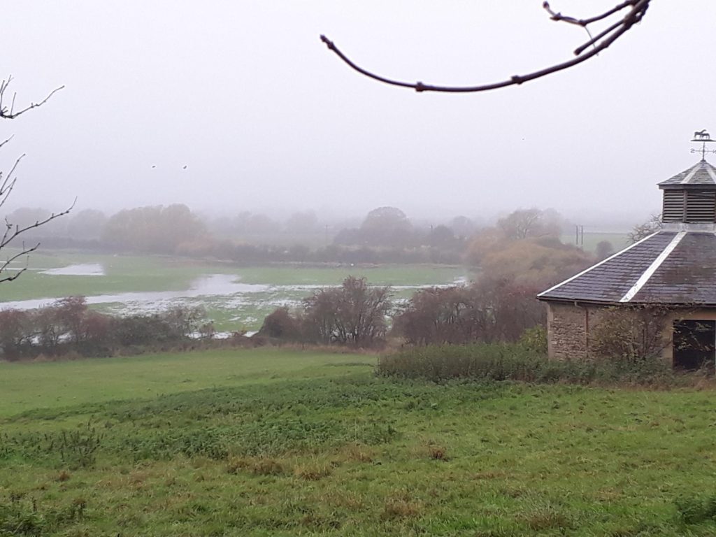
The Old Hayes proposed solar site is in the floodplain of the River Cole.
The floodplain performs an important water storage function, with implications for the River Thames c3km downstream to the north. The water quality and flow of the River Cole and its three tributaries which flow across the site, and the hydrology of the floodplain, are likely to be impacted by the proposed Solar Power Station.
Flooding is of two main types: River Flooding and Surface Water Flooding. Both occur here. New maps show the extent of flooded land on this proposed site, with projections for increased flooding to 2040-2060.
Surface Water Flooding is rainwater, which sits on the land and cannot infiltrate or flow off.
Read more...
New maps showing both River and Surface Water Flooding have recently been published and are available on www.gov.uk/check-long-term-flood-risk
The maps show Flood Zones 1, 2, 3a and 3b. Flood Zone 1 has low probability of flooding; Zone 2 has medium probability and Zone 3a high probability. Zone 3b is a Functional Floodplain, storing water from rivers during flooding or allowing water to flow through in periods of flood. Much of the land in the proposed site is in Flood Zones 2 and 3.
The published maps also project the likely scenario for future flooding in 2040-2060. Not surprisingly, due to climate change, the flooded area will increase.
Flooded sites are not suitable for a solar farm for many reasons. Indeed the whole site was under water or waterlogged for 4 months in the 2024/2025 winter.
There are many impacts of a Solar Power Station on river, stream and floodplain hydrology. The result an include severe reduction in the water-storage function of a floodplain, and damage to the soils.
A list of possible impacts of a Solar Power Station on river, stream and floodplain hydrology include the following:
- A large expanse of impermeable surface created by the solar panels would intercept rainwater and hence soil and watercourse flows.
- In summer low-rainfall or drought periods this reduction in water reaching the ground and infiltrating will be particularly acute; soil-drying has been recorded under panels in summer.
- New drainage ditches would probably be necessary, again affecting soil moisture and watercourse and river flows.
- Access tracks with hard surfaces would change natural water movement pathways.
- The effect on soil hydrology by the installation of thousands of panel mountings inserted 3-4m into the ground is probably not well studied, but could dry out the soil by speeding transfer of water down the soil profile.
- A well-rooted grassland capable of intercepting pollutants and storing carbon could take a long time to establish on this site – possibly many years.
- Vegetation growth can be poor in the shade beneath solar panels, resulting in poor organic matter delivery, poor soil carbon and increased compaction (Carvallho et al, 2025. https://eprints.whiterose.ac.uk/221644/ ). These factors affect water movement through the soil.
- Construction is likely to yield excessive amounts of silt and fine-particle sediment which would impact the water quality in the river and streams. While the water quality is not at present good, it could be expected to decline further.
- There may be extra demand for water for cleaning the solar panels and site maintenance.
All these factors would compromise the water-storage capacity and full functioning of this important floodplain – with consequent downstream impacts on the River Thames, as would the very major disturbance to the whole site during construction.
‘Standard practice’ when preparing a Solar Power Station site results in topsoil loss, compaction and sometimes use of gravel and/or geotextiles, greatly reducing the ability of the site to absorb storm water.
On flooded sites solar panels may have to be raised up to 4m above ground, with major visual impact on the landscape.
Risk of increased flooding to properties and adjacent farmland
Watercourses on the projected Solar Power Station site are linked with those on land to the north downstream. Any new drainage on the Solar Power Station site, or new features which may impede water flow, could affect levels in these streams and increase the likelihood of flood damage to property.
The flood levels in the River Cole are affected by management of the River Thames control structures in high rainfall periods. Any increase in run-off input from the Solar Power Station site at such periods could result in flood waters lying longer on adjacent farmland upstream and downstream. Detailed hydrological modelling, taking into account management of the River Thames controls, is needed to investigate the impacts of this issue.
Flooding can also occur from groundwater, ie upwelling of water held in strata beneath the surface. Groundwater flooding occurs on this site. During their trenching survey, archaeologists regularly had their trenches filled and trench walls collapse from groundwater. This would likely affect all the proposed construction work and cause additional damage to soils and their water-holding capacity.
The water-bearing layers below ground form an aquifer. This should be valued as a contributor to water levels in the River Cole and streams, especially by means of slow seepage when soils are drier during summer periods.
A further damaging impact of solar farms on streams and rivers occurs in dry summers, when evaporation of the limited amount of rain from the panel surfaces further exacerbates low flows in the watercourses, with damaging effects on water quality and wildlife. Hot dry summers are now expected, with climate change.


Wetland sites are not generally suitable for Solar Power Station for many reasons.
Read more...
Flood storage capacity may be reduced, with downstream impacts on flood management.
Extreme weather events such as storms can damage the solar panels.
Flooding can cause panels to be torn from the ground or their mountings.
Flood debris is caught in the panel frames resulting in greater depths of flooding.
Run-off from the panels causes erosion channels to form and the speed of run-off is accelerated.
Electrical devices such as inverters and batteries can short-circuit if exposed to flood water.
Even when dried out, water residues can lead to corrosion of electrical components.
Contact with water and abrasion caused by debris can damage the insulation of cables and other components, reducing performance or resulting in complete failure.
Wetland insects can be adversely affected by the light reflection from the solar panels.
Feeding grounds for flocks of wintering wildfowl and waders would be reduced or destroyed.
www.renewableenergyhub.co.uk
www.bsg-ecology.com (BSG Ecology Consultancy has delivered support to the solar farm industry).

Impact: Wildlife & Biodiversity
The proposed site for Old Hayes Solar Power Station is currently mainly intensively farmed arable land. However, this is NOT a nature-depleted site.
There is significant nature conservation value here. The arable land is utilised by important populations of breeding and wintering birds. The site is an active and functioning floodplain, with good expanses of permanent grassland, ancient and species-rich hedgerows and old trees. There is a Regionally Important assemblage of bats, with 11 species recorded, including rarities. Otter, water vole and badger are among the protected species.
Curlew, Red-listed species dependent on wet grasslands, now incredibly rare in the south of the country and known to be nesting in this area.
The River, tributary streams, grass margins and hedgerows
The obvious principal feature is the River Cole itself, a UK Priority Habitat – see https://www.gov.uk/government/publications/habitats-and-species-of-principal-importance-in-england. This is a good stretch of river with a little-modified meandering course, not recently dredged, deeply incised only in part, no high embankments, and with many fine old crack willows and other trees and shrubs along the banks and in the channel. The Cole has a strong population of otter, and water vole is present.
Possible detrimental impacts of a solar farm on the River Cole include altered river flow, such as low flows in summer due to evaporation of rain from the panel surfaces, water quality decline with increased run-off of sediment during construction and from new drainage, and modified flow pathways from hardened tracks. See the section on Flooding and Hydrology impacts.
There are extensive swathes of rough grassland along the riverside, with good stands of wetland species and a reasonable variety of wild flowers. Wetland plants could be threatened if summer low flows are exacerbated. Three significant tributaries flow into the Cole across the site from the east. These watercourses are currently deeply incised with steep banks, well below field level, but several stretches have wetland species in the channels and along the banks, and good woody cover.
The nine fields remain as shown on the 1888 6" Ordnance Survey map, and several even date from 1666, with no subsequent enlargement / rationalisation – an unusual survival. The north boundary of the site is as it was in 1761 too, when all the land was meadow. Now all the fields are arable or short-term (wildflower mix) ley, as noted. All are waterlogged and many flooded, with standing water, during the winter – for 4 months or more during the 2024/2025 winter. Being a floodplain site, most are flat, or with slight rises. The flooded fields are useful feeding grounds for wetland birds.
All the fields are hedged, some being tall, bushy and with a good variety of woody species and standard trees. Virtually all have grass field margins too, some particularly wide, up to 20m, with wild flowers (natural and sown). The hedges and margins are likely to be damaged by the proposed solar farm. The margins would be reduced in width. The surrounding soil would be damaged by compaction during construction, and once compacted soils take many years to recover. Many of the hedges (>2,500m of hedge) would be bordered by hardened vehicle access tracks, damaging the hedge with vehicle fumes.
One field is of particular value
Read more...
The field at the southwest corner of the proposed site can be singled out as particularly good for nature conservation. It borders the River Cole on its sinuous western edge, and a backwater of the Cole on the south, beyond which is the National Trust’s Coleshill Fritillary Field, an important site with some 1000 snake’s-head fritillaries. Fritillary fields are Indicators of Local Distinctiveness (IOLDs) of the Upper Thames floodplains, and the grassland is a UK Priority Habitat - as defined here: https://www.gov.uk/government/publications/habitats-and-species-of-principal-importance-in-england.
The watercourses bordering this field are well wooded with fine old crack willows, those on the adjoining National Trust land featuring as Ancient and Notable Trees, three being recorded on the Woodland Trust’s Ancient Tree Inventory - www.ati.woodlandtrust.org.uk. Small patches of Wet Woodland, another UK Priority Habitat, occur here. There are tall bushy hedges along the other edges, and rough tussocky grass margins and large stands of wetland vegetation. The field was under permanent grassland until recently. It is currently sown with a wildflower seed mix. The proposed site for the solar farm battery storage facility is very close to this valuable field. It should not form part of the proposed Solar Power Station.


Birds of Hedgerows, Wetlands and Arable Land
Hedgerows on the proposed Solar Power Station site support good populations of farmland birds.
Read more...
Tall and bushy hedgerows with flowering and berrying shrubs and a variety of woody species are a valuable feature for nature conservation and a UK Priority Habitat in their own right (habitats of principal importance – see https://www.gov.uk/government/publications/habitats-and-species-of-principal-importance-in-england ). In combination with food resources such as seeds in field margins, hedgerows can be critical for farmland birds. This bird group is rapidly declining in the UK and so of special conservation significance (see the government’s Farmland Bird Indicator list, www.gov.uk/government/statistics/wild-bird-populations-in-the-uk/technical-report-paper-the-wild-bird-indicator-for-the-uk-and-england ).
The hedgerows along Snowswick Lane and in places on the adjacent land support good populations of farmland birds. These include chaffinch, greenfinch, yellowhammer and linnet, the last 3 being Red-listed Birds of Conservation Concern, an indication of their decline and threat-status – see www.bto.org. Corn bunting, Red-listed, is in the area. Kestrel (Amber-listed), barn owl, buzzard and red kite hunt over the land. In the winter flocks of fieldfare (Red-listed) and redwing (Amber) feed on the berries.
Impacts on farmland birds on Solar Power Station have been little studied. The studies that do exist show variable results – some positive and some negative. Impacts on birds may result from construction disturbance, after which hedgerow management will be key.
Wetland birds
Wildfowl and waders use the flooded arable fields and the River Cole corridor on the Old Hayes Solar Farm proposed site. Feeding grounds for these birds would be lost or severely reduced with this development. The potential for real biodiversity gain for this important group is being shown by National Trust initiatives on the Cole floodplain upstream.
https://www.nationaltrust.org.uk/visit/oxfordshire-buckinghamshire-berkshire/buscot-and-coleshill-estates/nature-recovery There would be no such option here.
Birds and plants of arable land
At least two Red-listed species, skylark and lapwing, breed on appropriately managed arable land. These would not survive a solar farm development.
The developer's Ecological Impact Assessment on the Application website includes lists of birds recorded (Tables 15-21, pages 45-54), although a large date-set of long-term monitoring results was not consulted.
Rare plants of arable land and arable margins form another assemblage of rapidly declining species. There could be potential for true biodiversity gain here, for which there will be no option under this proposal. The developer's Ecological Impact Assessment did not include this important feature at all.
Biodiversity Net Gain

Biodiversity Net Gain (BNG) is a mandatory planning requirement for development sites, whereby wildlife habitats must be left in a better state than before development, either on the site to be developed or elsewhere. There are specific methods for working out the BNG for a site. BNG must be at least 10% enhancement of the current biodiversity value.
For full information on this concept: www.gov.uk/government/collections/biodiversity-net-gain
Many Solar Farms claim BNG because arable land is changed to permanent grassland, a habitat which can reduce soil erosion, potentially hold and store soil carbon, create a (sown) habitat with an abundance of wild flowers (for pollinators and other invertebrates). For example, the huge Botley West Solar Farm proposal claims a BNG of 76%, largely based on replacement of arable with grassland. This metric is likely to be claimed for the proposed Old Hayes Solar Farm.
BNG is also frequently claimed on account of new tree planting, new hedgerows or more wildlife-friendly management of hedgerows (such as letting them grow taller and bushier, and planting up gaps), and sowing new grass margins adjacent to hedges and watercourses.
However, BNG needs scrutiny, as essentially an area of unspoilt countryside is lost, and any options for more ambitious and genuine biodiversity gains are impossible for the coming 40 years. There are also many problems with the practicalities of implementing BNG on the ground.
What the press Say...
“Biodiversity Net Gain” if a Solar Farm is developed?
In the case of this proposal, for Old Hayes Solar Farm, there is already significant nature conservation value. The arable land is not of particular value, soils are likely to be in poor condition, compacted, and the light alluvial soils prone to erosion during floods. Thus in this context permanent grassland could indeed be a BNG. However, the site is an active and functioning floodplain, and the grassland should ideally be floodplain grassland, of value for wetland species including rare and declining wetland birds – not an option under the current proposal.

The various features of nature conservation value have been outlined – the River Cole, a Priority Habitat, tributary streams, hedges, trees and field margins.
Understand The Impacts
Net Gain would be to manage the whole site as wet grassland or other wetland habitat, with minor changes to hedgerow management and enhancement of watercourse profiles. Such management is providing major wildlife benefits upstream on National Trust land and is proposed for other Trust land near this site. The proposal for a solar farm in this location conflicts with ambition for the River Cole corridor and its wider catchment.
Read More With the National Trust
“Biodiversity Net Gain” for the floodplain?
With a solar farm, the main gain could be a positive effect on water quality in the river and tributaries if the site was changed from arable to permanent grassland, reducing run-off of silt and nutrient-rich water. The grassland would probably be managed without fertilisers, reducing nutrient loading.
However, there are many unknowns related to the construction and management of a solar farm. It may well be difficult to establish a well-rooted grassland capable of intercepting pollutants and storing carbon.

Many grasslands in solar farms are poor in plant diversity and managed with herbicides for weed control.
https://solarenergyuk.org/resource/solar-habitat-2025/
Poor vegetation growth in the shade beneath the panels reduces soil carbon accumulation and soil quality (Carvallho et al, 2025. https://eprints.whiterose.ac.uk/221644/ ). And there are many likely changes to the hydrology of the River Cole, streams and the floodplain soils and function.
“Biodiversity Net Gain” for hedgerows & birds?

Solar Farm proposers frequently cite new and improved (taller, bushier) hedgerows as an element of claimed Biodiversity Net Gain. This Old Hayes site already has hedgerows, some of which are tall and bushy and already of value for birdlife. Indeed, modifying hedgerow management is an easy win for biodiversity that can be carried out by any land manager at little cost.
The RSPB has recently published a statement “Solar farms managed for nature can boost bird numbers and biodiversity”, February 2025.
https://www.rspb.org.uk/whats-happening/news/solar-farms-managed-for-nature-boost-bird-numbers-and-biodiversity
This has been repeated by Solar Energy UK in their 2025 publication promoted to MPs.
https://solarenergyuk.org/resource/solar-habitat-2025
The RSPB's statement refers to solar farms in arable-dominated landscapes and is based on a study (reference below) comparing intensively managed arable land in the Cambridgeshire Fens with nearby ‘mixed-habitat’ solar farms and ‘simple’ solar farms. Read more…
The mixed-habitat solar farms had hedgerows, hedgerow trees and wild flower margins. The ‘simple’ solar farms and arable sites had none of these features. Unsurprisingly, the mixed-habitat solar farms benefitted both woodland and farmland birds, in both variety and numbers of species. These included blackcap, chiffchaff, dunnock, jay, lesser whitethroat and willow warbler amongst the ‘woodland’ species, and farmland birds corn bunting, goldfinch, greenfinch, linnet, reed bunting and yellowhammer, plus cuckoo. Neither the arable nor simple solar showed this positive effect, with the notable exception of skylark and lapwing being most abundant in the arable.
The study emphasised the critical importance of infrequent cutting or grazing management of the grassland around the panels; regular cutting or grazing rendered the solar farm no better than intensive arable for birds.
This finding on solar farm management is supported by bird monitoring at Westmill Solar Farm, near Coleshill, where the areas round and under the panels are sown with a meadow mix. The security fencing also has a positive impact, with lack of disturbance meaning that productivity for ground-nesting birds is much higher than in the surrounding landscape.
The RSPB study notes that there is very little existing research on the impacts of solar farms on biodiversity, and indeed the few studies that exist have produced mixed results – some positive, some negative. References are given to bat activity being negatively affected, bumblebees and pollinating insects being positively affected if the solar farm is wholly managed as wildflower meadow.
The conclusion is “In nature-depleted landscapes, like arable farmland, solar farms managed for mixed habitat can increase bird abundance and biodiversity”. It is important to repeat that the Old Hayes proposed site is not a nature-depleted landscape, already with mixed habitat.
Reference: Copping, JP, Waite, CE, Balmford, A, Bradbury, RB, Field, RH, Morris, I and Finch, T.. 2025. Solar farm management influences breeding bird responses in an arable-dominated landscape. Bird Study, published on line February.2025
https://www.tandfonline.com/doi/full/10.1080/00063657.2025.2450392
Impact: Archaeology & Land-Use History
Archaeological interest is covered in a report for Cotswold Archaeology (Donaldson, K and Sabin, D. 2023. Archaeological Surveys Ltd. Land off Snowswick Lane, Coleshill, Oxfordshire. Magnetometer Survey Report for Cotswold Archaeology (draft).
https://data.whitehorsedc.gov.uk/java/support/Main.jsp?MODULE=ApplicationDetails&REF=P24/V0178/SCO#exactline
The report can be found as Appendix D among the Scoping Opinion Request Supporting Documents.
The proposal indicates that solar panels would not be placed on this settlement site – see the area left white on the site map.

Map provided by ABEI Energy with their proposal documents, 2022. Zoom in to see the detailed key. The red line shows the site boundary and the turquoise colouring the positioning of the solar panels. The central area is left with no panels due to its archaeological interest. Otherwise panels cover virtually the whole of the proposed site.
The field pattern and tributary streams are all as shown on the 1888" Ordnance Survey map, with no rationalisation or enlargements. The northern boundary is as shown on a map of 1791. All the fields were meadow at this time. This is an interesting historic landscape survival in itself. Interestingly the Cotswold Archaeology report states that the site contained very few sources of modern disturbance, which may accord with the survival of the field and boundary lay-out from the 18th and 19thCs.
Impact: Public Access
There is currently no public access in the proposed Old Hayes Solar Power Station site. Other solar farms have provided new footpaths as a ‘mitigation’ for local people. Whether or not this is a possibility, and would be compatible with remaining wildlife, remains to be seen.
Snowswick Lane, on the other hand, is a popular route for cyclists, walkers, runners and horse riders. Footpaths across King’s Hill and the fields to the boundary of Worsall Farm afford beautiful views of the valley landscape where the solar “farm” is proposed. These footpaths are highly popular with local walkers and visitors.

Impact: Change & Disruption In Snowswick Lane
Snowswick Lane between Coleshill and the Lechlade-Faringdon road is currently a peaceful and attractive traditional country lane, well hedged all along and bordered by farmland. The hedges are important for declining farmland birds which can be enjoyed in flocks in winter and summer.
The lane is the only artery for construction and maintenance of the proposed Old Hayes Solar Power Station and its character would be irrevocably altered.. It seems extraordinary the developers can propose such an unsuitable route for large and heavy construction vehicles, claiming this is ‘good highway access’. A member of the Parish Council’s Focus Group has carried out a detailed survey of the lane’s widths, surfaces, verge conditions, road junctions and claimed ‘passing places’ (of which there are none), clearly demonstrating that this route is in no way suitable for the proposed change in use.
The lane is frequently flooded in three main locations, and closed for flooding. Similarly the A417, Lechlade to Faringdon road, is often flooded, and its junction with Snowswick Lane is dangerous.
Access for the farms and houses along the lane
Access for the farms and houses along the lane would be compromised. The lane has sharp bends and blind spots, and would be dangerous for all users.
Snowswick Lane is currently well-used by cyclists, and part of a promoted circular route:
“Starting at the Badbury Hill National Trust car park near Great Coxwell a few miles north east of Swindon this route is a combination of generally flat terrain with a couple of testing hills thrown in to keep you on your toes. Using mostly quiet lanes this route will pass through lots of small villages and National Trust properties giving those that want to stop off and explore plenty of opportunity to turn this in to a full days cycle touring.”
https://cyclinglabs.net/oxfordshire-leg-stretch
Local businesses in Coleshill and Lechlade benefit from cyclists’ custom.
The proposed total change in use from this rural lane into an industrial highway is unrealistic and impractical, and the Focus Group trusts that the Planning Application may be refused on these grounds.


Risks

Solar Farms
